

MAPS OF CERTAIN DISTRICTS
SB 475 requires local election districts (like county commissions) to create digital GIS maps of their boundaries by collaborating with New Mexico’s Secretary of State and the University of New Mexico’s Earth Data Analysis Center. Districts must submit these maps to the Secretary of State and all affected county commissioners by March 1, 2027, and every two years after the federal census. The bill appropriates $200,000 to fund the University of New Mexico’s center to assist districts with map creation. This policy mandates standardized map documentation for election districts, aiming to improve boundary clarity and accessibility.
Bill status
in committee
1 of 4 stages cleared
Introduction
Feb 2025
Committee Review
Floor Vote
Governor
Introduced Feb 20, 2025
Last action Jun 3, 2025
Floor votes
How they voted
No floor votes recorded yet.
Full legislative history
Actions timeline
Total actions
2
Key actions
0
Committee
0
Feb 20, 2025
Introduced
Sent to Senate Rules Committee & Senate Finance Committee
upper
1 primary · 0 co-sponsors
Sponsors
Role
Legislator
Party
State
District
P
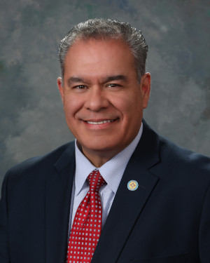
Michael Padilla
DDemocratic
Ask Maddy
·
AI policy assistant
Ask Maddy about SB 475
Scope: NM
Hi! I can help you understand SB 475. What would you like to know?
Try one of these
i
Maddy answers using official bill text and legislative records. Always verify before sharing.
Sources cited inline